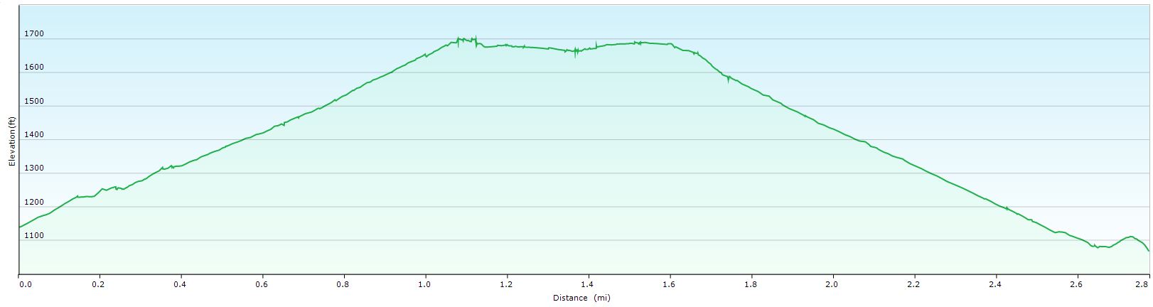
Distance: 2.8 miles Ascent: 620 ft Time: 1 hour 30 minutes
This is the Rookhope “gym”, a continuous and not so gentle ascent on a good track with excellent views. On a calm day on the valley floor below the gusts of wind funneled down the narrow cutting just before the top can stop you in your tracks.
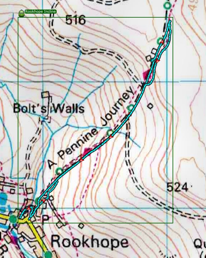
Map: Explorer 307 Consett & Derwent reservoir
Click on the image for larger picture
Start: The Rookhope Village Hall car park is often locked so park considerately in the village. The walk starts up the stony track opposite the shop.
Directions:
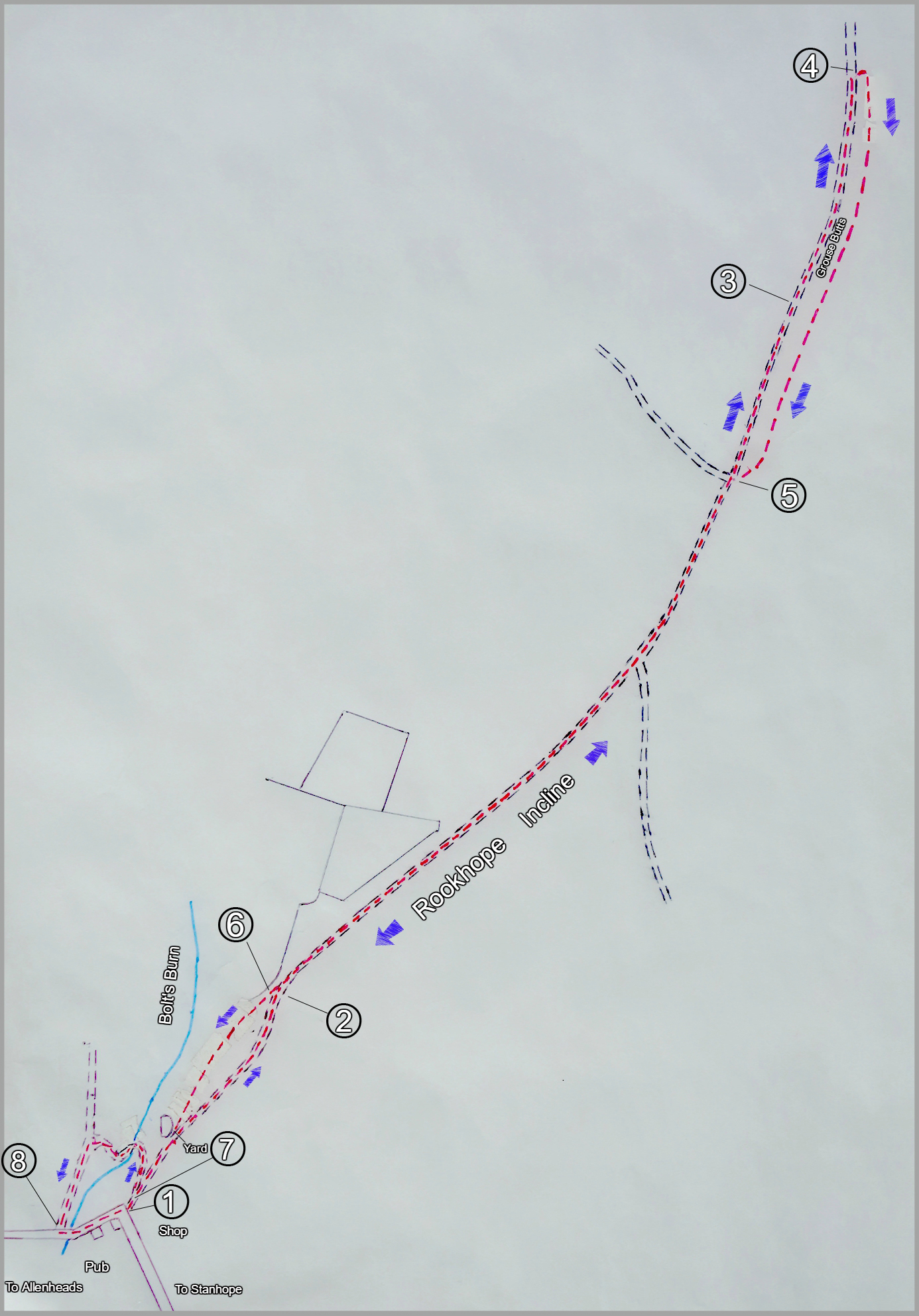
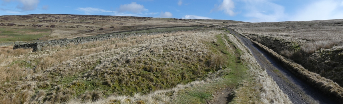
1.The cluster of buildings on the left as you start were once Rookhope’s mill. Look left after 30 yards up the track and note the slight depression in the land above the “mill” which is dissected by a track. This was the mill pond. Further up pass a small yard and turn left at the two track junctions to reach the fell gate and the track bed of the old Rookhope incline railway.
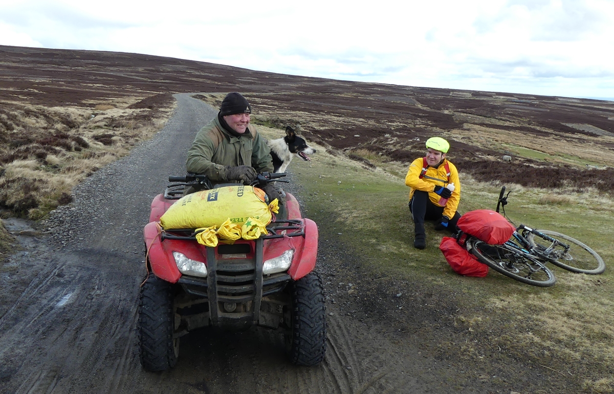
The track is on the route of the coast to coast cycle path (C2C) and for the cyclists who you see pushing their bikes, or even occasionally riding them, the hilltop ahead at 1600 feet is the final peak before the slow descent to the sea at Sunderland.
This is a good spot in the spring to see wading birds, such as lapwing and curlew, which come up from the coast to nest on the moors of the North Pennines. Their chicks, which feed themselves from a few days old, root around for insects and larvae, and later earth worms, in the boggy soils
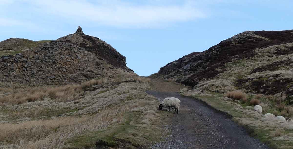
2. From the fell gate climb steadily for a mile to the “top station”.
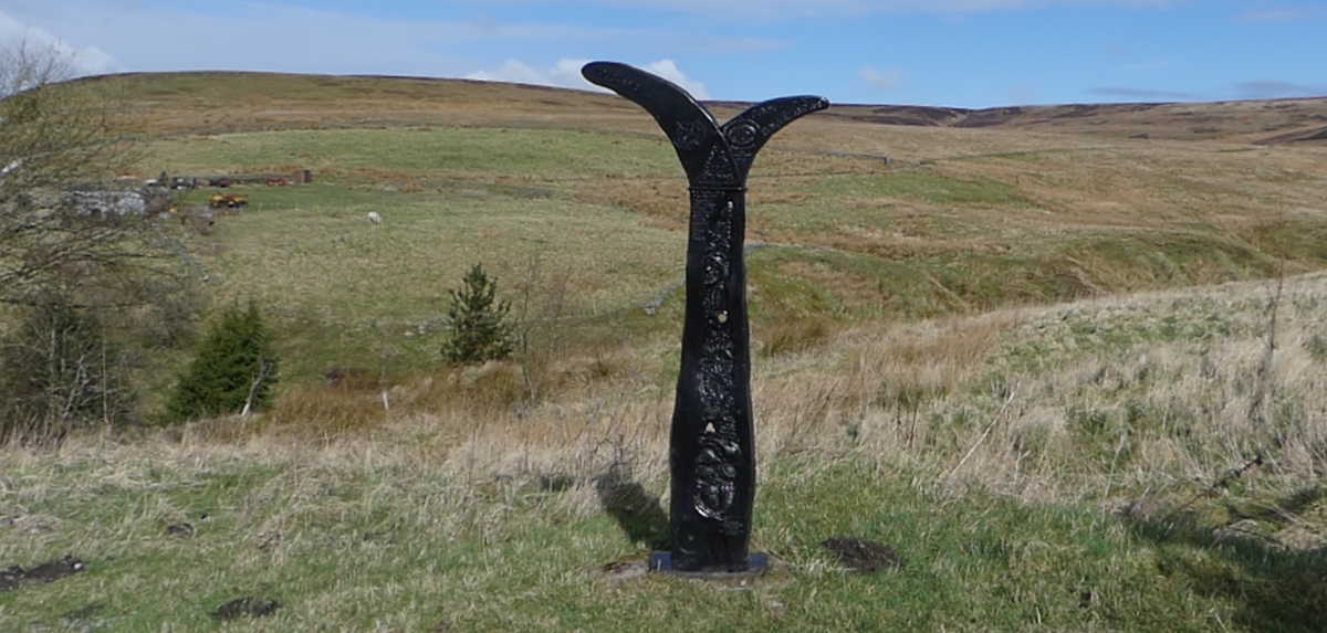
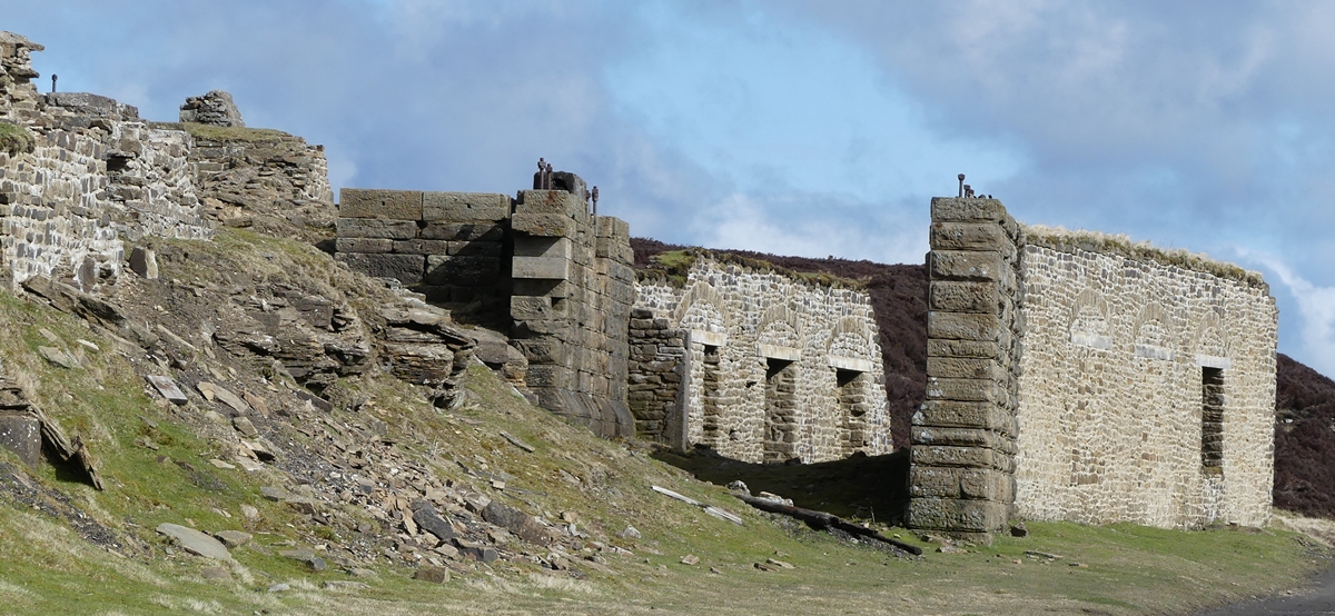
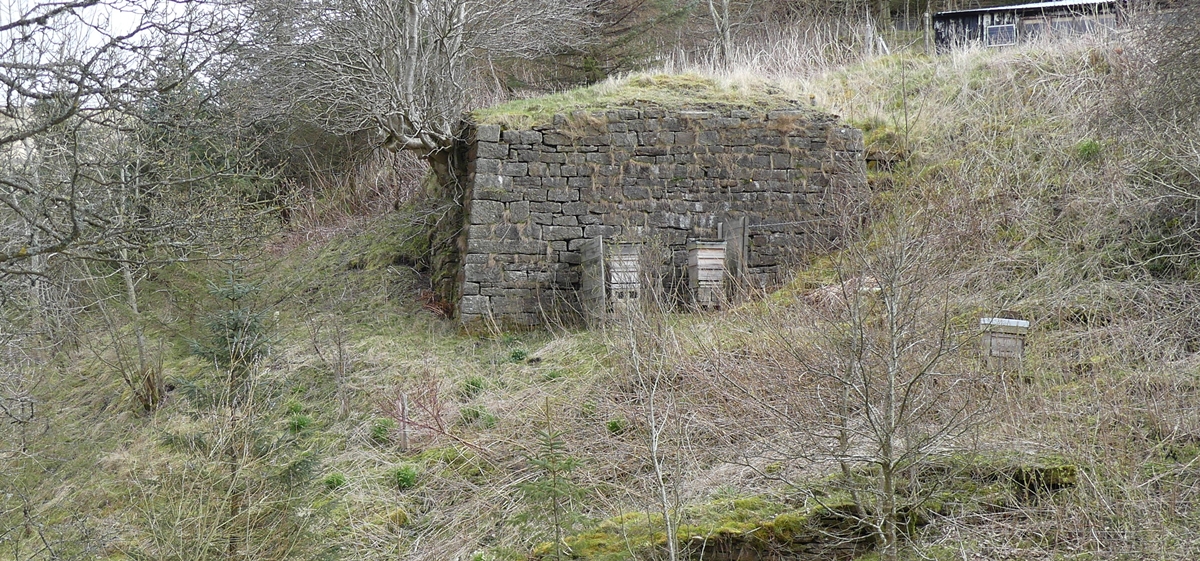
The remains of the buildings which housed the steam engine and cable drum for the Incline railway and the train sheds for the railway to Sunderland are in a manmade amphitheatre after the final cutting and were recently consolidated. Opposite the excellent Durham Council explanatory board is a short track up to a rock slab memorial seat with excellent views. This makes a good picnic spot.
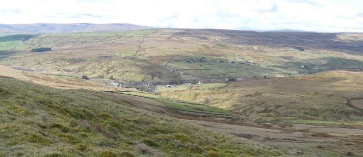
3. Continue along the old rail track for 300 yards to a grouse butt on the right where a grand vista over the valley of the Stanhope Burn opens out.
4. Make a 180 degree turn at the grouse butt to follow a green track with more butts to the right. Ignore a turn to the left and after 600 yards the track bends down right to rejoin the incline path.
5. Turn left towards Rookhope.
6. At the bottom of the hill where the track turns left to the fell gate continue straight ahead over a stile. This is the true route of the incline railway. Where the path swings left at the yard to rejoin the track the railway carried on downhill to the right. Continue down the track.
7. 30 yards before the road take the track to the right and note the diagonal cut on the slope ahead where the Incline railway track came down. Soon take either the narrow footpath up to the right which leads to a footbridge or paddle through the ford ahead. Turn right to a hairpin bend and observe the stone piers between which wooden trestles carried the Incline railway over Bolt’s Burn. An accident at this spot in 1922 led to the closure of the line and an aerial bucket system was then constructed to carry Rookhope’s mineral production down to the railway at Eastgate. Follow the track up and then down to the left. Just before the road look over the wall to the left to see the line of the train track which came down from your left to pass under the road bridge, then across the Rookhope Burn to meet the Rookhope to Middlehope trainline.
8. At the road bear left and the start of the walk is 100 yards ahead after a stop at the welcoming Rookhope Inn.
GPS:
 |
You can download the .GPX file of the walk for your GPS – (as a .zip file)
Please Click HERE to download |
Images:
Click on the image for larger picture


A Video of The Walk:
Comments are closed.