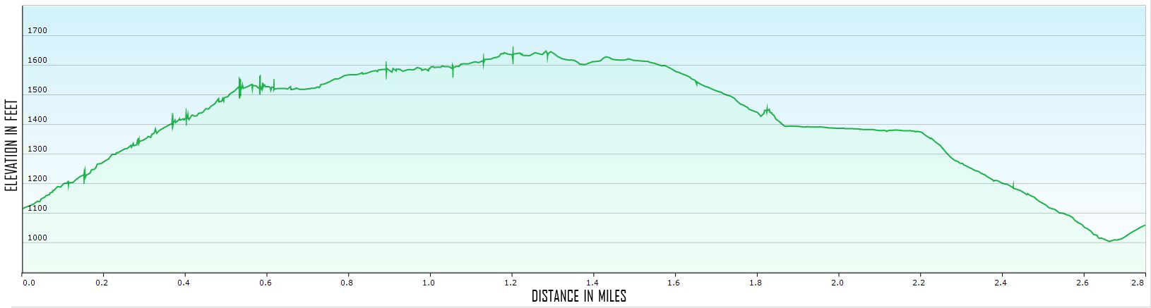
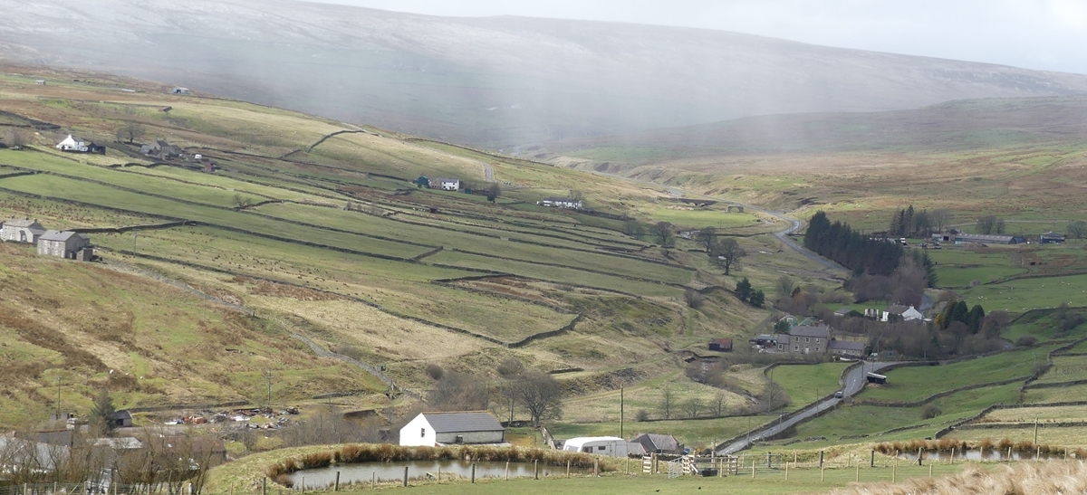
Description: This walk amply demonstrates the complexity and variety of views offered by the Rookhope valley, which help make Rookhope the premier walking venue in Weardale. Two versions of the walk are described here – a “there and back” walk which makes a fine workout and a longer circular one. The walk starts steeply then rises more gently towards the top ridge. Some yomping over tussocky terrain is required.
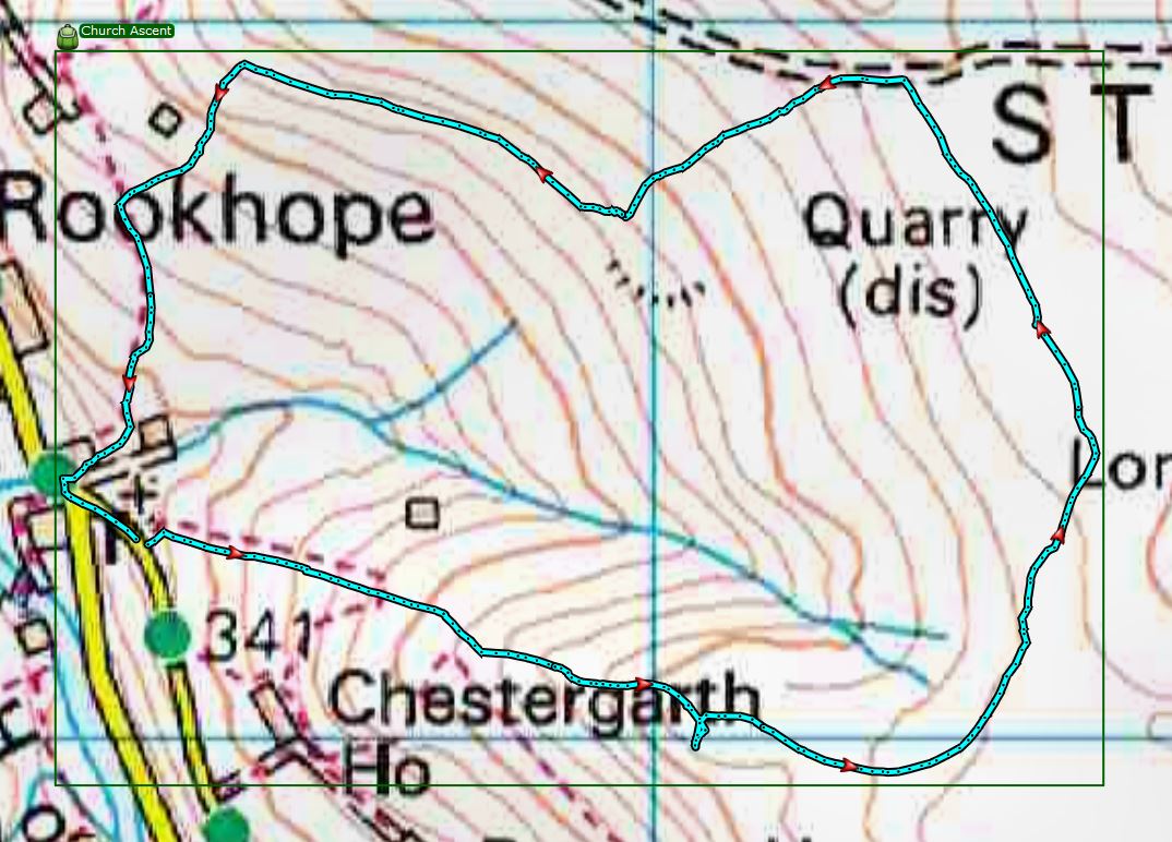
Map: Explorer 307 Consett & Derwent reservoir
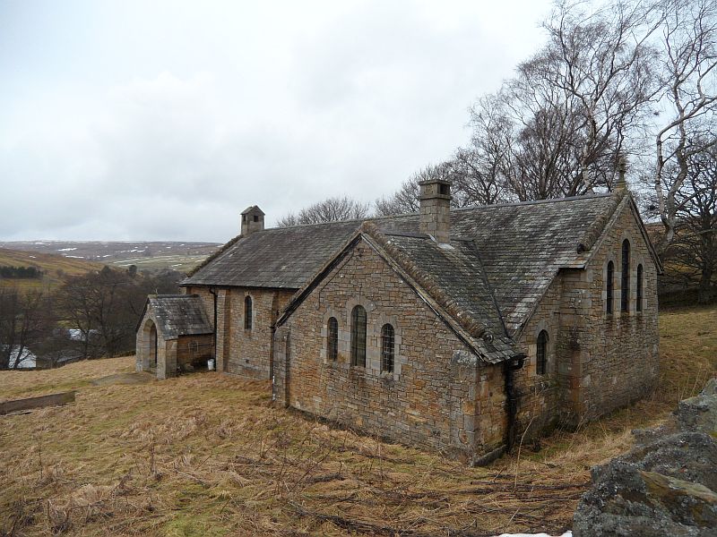
Start: Park carefully near the former Rookhope Church (now a private residence).
Click on the image for larger picture

Directions:
1. Follow the way marker at a gate to the right of the former church. The path turns right at the corner and then rises steeply up through three fields to the fell gate. (The third field is permissive only to avoid passing by Chestergarth House).
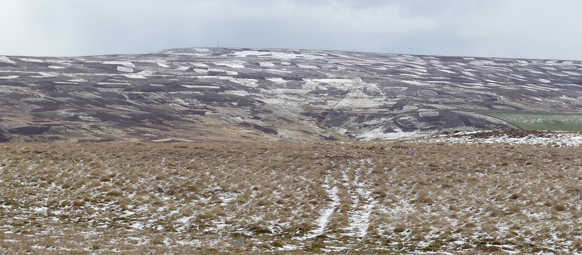
2. Continue uphill on a path which soon becomes a track. At a track crossroads by the crumpled remains of a metal shed keep ahead to reach a plateau which is Dodder Hill. The pox marked surface of the hill is caused by ancient ironstone workings. More recent ironstone workings are evidenced by the industrial scale spoil heaps of Wright’s Groove Quarry up to the left and further left are the workings of Greenhill Quarry. (Does anyone have dates or other information for these quarries please?)
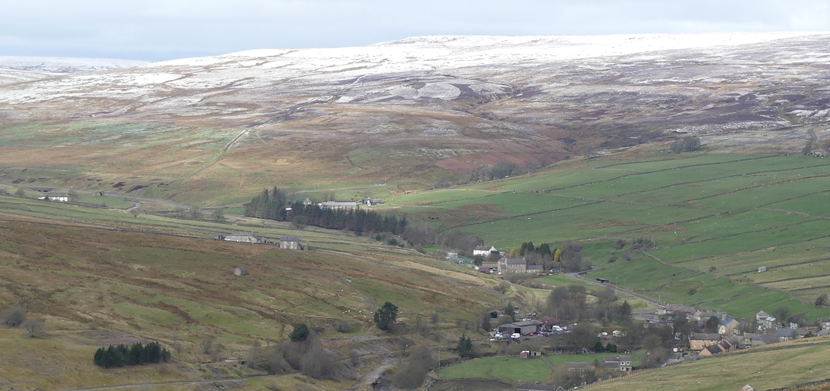
3. The narrow path which bears left as you climb on to Dodder Hill is your onward route but for now follow the track for 100 yards and then climb over workings on the right for views down the Rookhope valley towards Weardale. Return to the narrow path which now threads its way more damply uphill curving to the left for 800 yards to meet a wide cross track. (If you are doing the short return walk note carefully this junction, your upward (and soon to be return) path behind you and the pile of stones a little further ahead, as it’s easy to become disorientated on the way down. After visiting the cairn ahead return to the stones and take the narrow path curving down to the right (your upward path), pass through the workings on Dodder Hill, descend to and pass the broken shed and then select the rightmost of the three gates in the fell wall ahead. Proceed down to the old church with the wall on your left to the start of the walk.) .
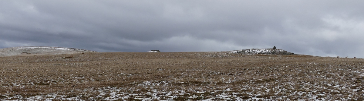
4. For the circular walk continue to the cairn with its stone shelter an ideal picnic spot on a windy day and for views down into the valley of the Stanhope Burn. From the cairn follow the ridge to a sheepfold, another cairn and then walk in the same direction to reach a well made track.
5. Turn left on the track and then as the track bears right after 200 yards, head down over rough ground towards the right side of the spoil heaps of Wright’s Groove quarry to find another track below. (This was once the path of the tramway which linked Wright’s Groove and Greenhill quarries to the Rookhope Incline railway and thence to the iron and steel works at Tow Law and Consett.)
6. Turn right on the track for 800 yards to reach the spoil heaps of Greenhill quarry and then 200 yards later look down left to see the tin roof of a large shed set in an oversize sheepfold. (There is a house with a curious brown roof structure just to the right.)
7. Yomp down the slope and pass the sheepfold to the left to reach a cross wall.
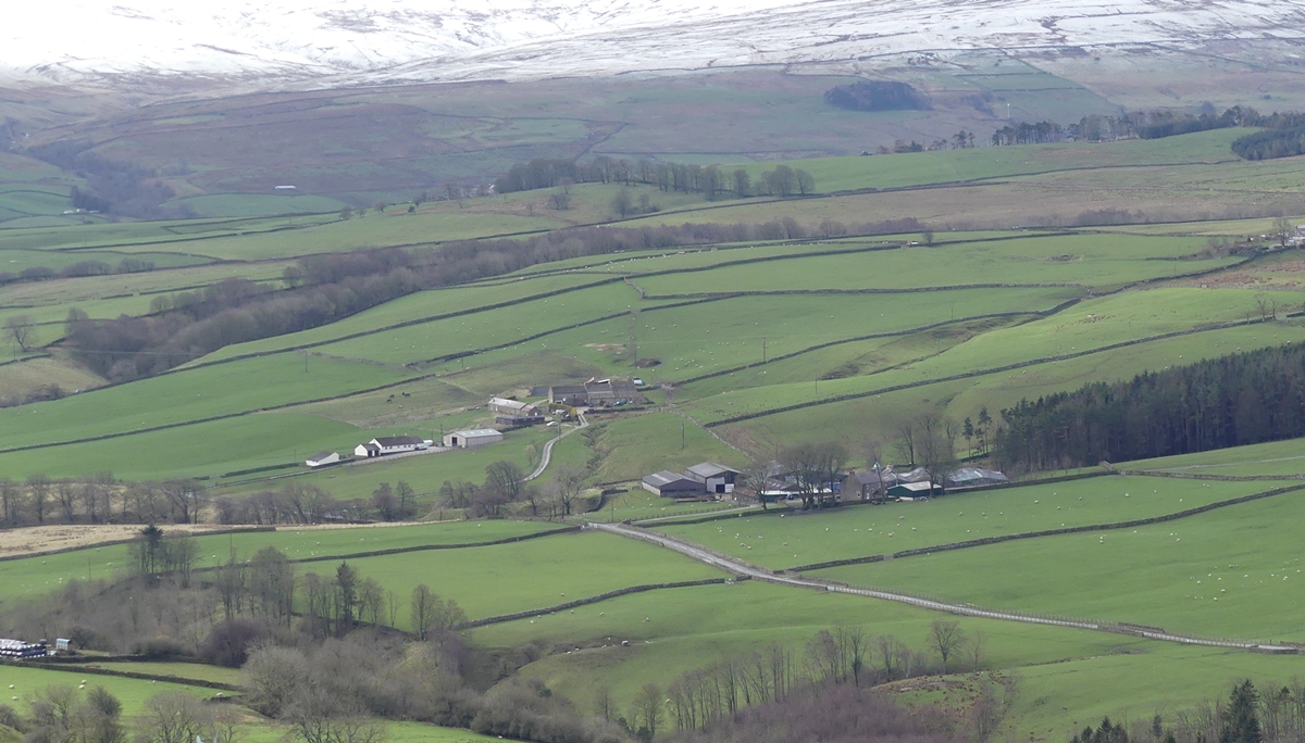
8. Turn left through a gate and you are now on a footpath which leads between two old barns and after 800 yards past a farmhouse to reach a road.
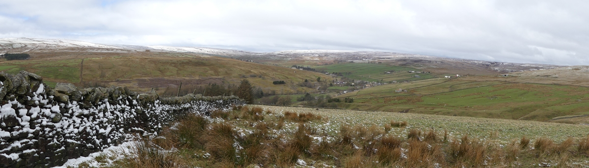
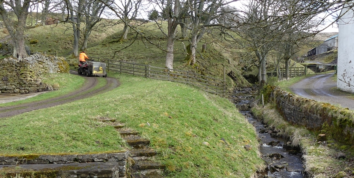
9. Turn left here, noting the pretty Stotfield Burn, and left again after 30 yards at a road junction back to your car a little way ahead.
GPS:
You can download the .GPX file of the walk for your GPS – (as a .zip file)
Please Click HERE to download
Images:
Click on the image for larger picture


Comments are closed.